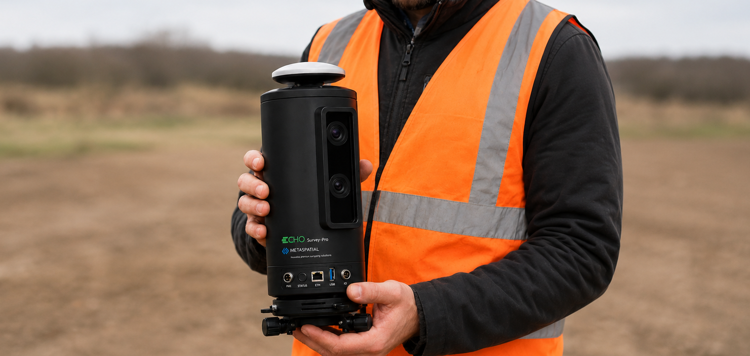

What Is Echo Survey?
Echo Survey is an innovative, patent-pending photogrammetric surveying and control system that combines robotic positioning, image-based measurement, GNSS RTK and illuminated optical targets to connect precise site coordinates with clear visual context.
Rather than relying only on isolated points and numerical measurements, Echo Survey shows users what is being measured, where it is located within the real scene and how it relates to the project design. It supports visual setout, precision levelling, alignment verification, build-versus-design comparison and continuous site monitoring through one connected platform.
24/7 Visual Setout and Automated Monitoring
Traditional setout is often completed as a point-by-point activity during scheduled site visits. Once the instrument is removed, there may be no continuous visual record showing what changed, whether installed work remained within tolerance or when a deviation first appeared.
Echo Survey can be permanently installed in a similar way to a site monitoring camera while retaining measurable surveying capability. Engineers, operators and builders can remotely view the site, access live visual setout guidance, verify completed work and monitor progress without waiting for another specialist visit.
Time-stamped, measurable images provide an auditable history of site conditions, supporting continuous quality control across shifts, subcontractors and construction stages.
GNSS RTK and Full Surveying Capability
Integrated GNSS RTK enables Echo Survey to establish and operate within recognised project and site coordinate systems. Measurements, setout points, levels and monitored changes can therefore be connected to the same control network used by surveyors, engineers and construction teams.
This supports conventional surveying functions alongside visual workflows, including:
- Site control and coordinate establishment
- Precision 3D measurement
- Visual setout
- Level and elevation checks
- Plumb and alignment verification
- As-built measurement
- Progress and deformation monitoring
Live Design and BIM Comparison
Through the integrated MetaSpatial Evolve platform, live imagery can be combined with 3D design models, BIM data, CAD information and project control.
Users can view design geometry overlaid on the live site image, making it easier to understand where elements should be located and how completed construction compares with the intended design.
This supports faster identification of:
- Position and alignment errors
- Level and elevation differences
- Plumb deviations
- Missing or incorrectly installed elements
- Construction progress
- Tolerance exceedances
- Changes between inspections
The visual comparison makes complex spatial information easier to understand for both technical and non-technical users.
AI-Assisted Visual Intelligence
Echo Survey integrates AI to assist the human eye in identifying anomalies, deviations and conditions that may otherwise be overlooked during manual inspection.
AI does not replace professional judgement. It provides an additional layer of consistent visual review, helping teams identify areas that require attention and prioritise further investigation.
Detection workflows can be customised for different projects and applications, including:
- Plumb and level conditions
- Alignment and dimensional deviations
- Surface defects and anomalies
- Missing components
- Installation progress
- Safety hazards
- Restricted-zone activity
- Movement or change over time
- Project-specific objects and conditions
Custom actions can be triggered when defined conditions are detected, including alerts, measurement requests, image capture, reporting or escalation to selected users.
Multi-User Collaboration and Teamwork
Echo Survey and the Evolve platform create a shared visual environment where engineers, surveyors, operators, builders and project managers can work from the same measurable information.
Authorised users can remotely:
- View live and historical imagery
- Review measurements and design overlays
- Compare construction against BIM or CAD models
- Add comments and annotations
- Assign findings
- Review AI detections
- Confirm or reject identified anomalies
- Generate reports and evidence
- Collaborate across offices and project locations
This reduces communication gaps between field and office teams and provides a common visual reference for decisions, approvals and quality-control activities.
Safer and More Accessible Site Control
Permanent and remote operation can reduce the need for personnel to repeatedly enter hazardous, congested or difficult-to-access areas.
The system can provide measurable visual access to active work zones while supporting remote verification, progress monitoring and design comparison. This helps reduce unnecessary site exposure while allowing teams to maintain frequent oversight.
From Occasional Checks to Continuous Assurance
Echo Survey transforms surveying from a sequence of isolated measurements into a continuous visual control workflow.
By combining photogrammetric measurement, GNSS RTK, robotic positioning, AI-assisted detection, live design overlays and multi-user collaboration, it enables project teams to:
- See what is being measured
- Understand how it relates to the design
- Guide work visually
- Detect deviations earlier
- Maintain an auditable project history
- Collaborate remotely
- Reduce delays and rework
- Improve quality and safety